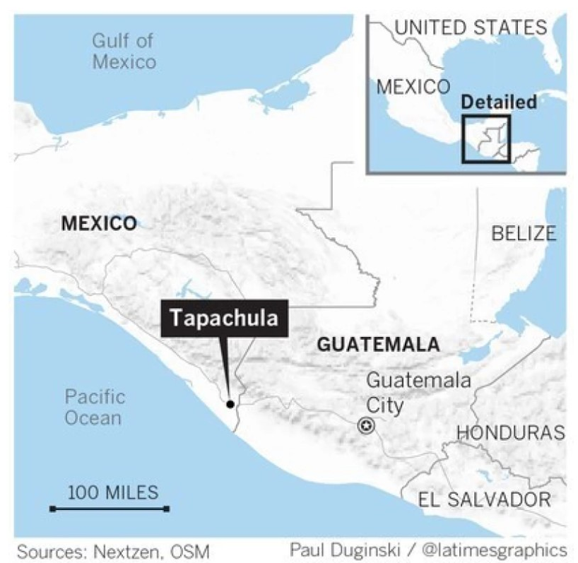

Mexico (/ˈmɛksɪkoʊ/; MEK-si-koh; Spanish: México, pronounced [ˈmexiko] (About this sound listen)), officially the United Mexican States is a federal republic in the southern portion of North America. It is bordered to the north by the United States; to the south and west by the Pacific Ocean; to the southeast by Guatemala, Belize, and the Caribbean Sea; and to the east by the Gulf of Mexico. Covering almost two million square kilometers (over 760,000 sq mi), the nation is the fifth largest country in the Americas by total area and the 13th largest independent state in the world.
With an estimated population of over 120 million, the country is the eleventh most populous and the most populous Spanish-speaking state in the world while being the second most populous nation in Latin America. Mexico is a federation comprising 31 states and a special federal entity that is also its capital and most populous city. Other metropolises include Guadalajara, León, Monterrey, Puebla, Toluca, and Tijuana.
The country is at the head of homicides, the corruption touches every single level of the administration, the liberty of expression is frequently threatened, the human development is equally falling behind and the 52% of the population live under the shadow of poverty.
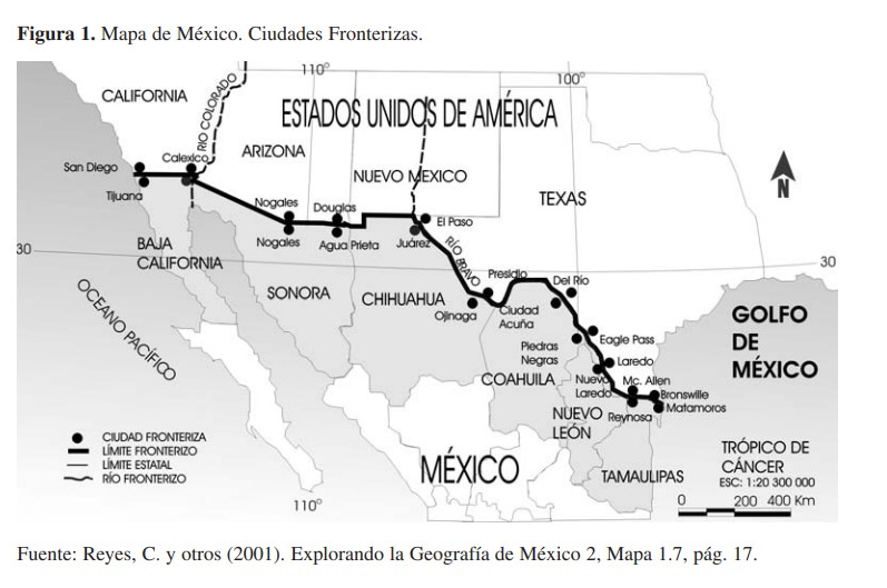
North and Southern Border of Mexico
Mexico has two borders: the northern one that marks the international limit with the U.S.A. and measures 3,152 km, and the southern one, with Guatemala and Belize, whose dimension is 1,149 km in total (956 with the first country and 193 with the second).
The cities on the northern border, where 6 of the 31 states of the country are located, from West to East: Baja California with 72,492 Km2 (3.7% of the total national area), Sonora has 180,251 Km2 (9.2%, 2nd place of the total area), Chihuahua contains 246,865 Km2 (12.6%, 1st in size of the national surface), in Coahuila there are 150,862 Km2 (3rd in the country) In Nuevo León there are 64,655 Km2 (3.3%), and Tamaulipas has 80,329 Km2 (4.1%), so there is 40.6% of the total national area. Four states are located on the US side: California, Arizona, New Mexico and Texas. In this international border are located 37 municipalities of the 2,443 existing as administration and government units in Mexico, and at least 12 population centers, whose ranges in the urban structure go from small to larger cities, such as Tijuana, Baja California, considered greater with 1,148,681 inhabitants; Mexicali, Baja California, medium city (549,873 inhabitants), Nogales, Sonora, small (156,854 inhabitants). Agua Prieta, Sonora, with the same rank as the previous one (60,420 inhabitants). Ciudad Juárez, Chihuahua, the largest of all, containing 1,187,275 inhabitants. The following four are classified as small, and are: Ojinaga, Chihuahua (20,371); Ciudad Acuña, Coahuila (108,159), Piedras Negras, Coahuila (126,386) and Anáhuac, Coahuila (15,976 inhabitants). The last three locations listed are in the middle range; thus, Nuevo Laredo, Tamaulipas has 308,828; Reynosa, Tamaulipas, 403,718; and Matamoros, Tamaulipas with 376,279 inhabitants. (INEGI, 2000).
Maps